

In short
The best Madeira hikes by level: Vereda dos Balcões for an easy start; Levada das 25 Fontes, Ponta de São Lourenço and Pico Ruivo from Achada do Teixeira for half days; and the Pico do Areeiro crossing or Levada do Caldeirão Verde for the long, hard days. Every classified route needs a booked slot.
Madeira's walking runs on two kinds of path. One follows a levada, one of the ancient watercourses cut along the island's slopes, descending gently beneath laurel forest towards waterfall pools. The other climbs the craggy central massif round Pico Ruivo, on rocky paths with steps, tunnels and ridges that cloud can cover without warning. A good week has both, and since every classified route now needs an entry slot booked in advance, the plan has to come before the boots. Every route carries a PR number, the code of Madeira's classified walking routes, and that code is what you book.
Where to stay
Hiking hotels in Madeira
Hotels we picked for the sport: the right location, and the facilities an active stay needs.

Which Madeira hikes suit an easy first day?
Two short walks make a gentle first day: Vereda dos Balcões in the forest at Ribeiro Frio, and the out-and-back on the high ridge from Pico do Areeiro.
How easy is Vereda dos Balcões?
PR 11 Vereda dos Balcões is graded easy: 1.5 km each way, 3 km in all, and about 1:30 hours. It starts on the ER 103 road at Ribeiro Frio and follows Levada da Serra do Faial, almost level between 870 m and 880 m, through Laurissilva, Madeira's native laurel forest. Look for the trees of the laurel family along the edges. The path ends at the Balcões viewpoint, over valleys thick with green forest, and on a clear day the three big peaks line the skyline: Pico do Areeiro, Pico das Torres and Pico Ruivo. Back at Ribeiro Frio Forest Park, the Aquaculture Centre keeps a rainbow trout nursery. It suits a first morning on the island, a family with young walkers, or any day the cloud sits too low for the summits.
How far is the Stairway to Heaven walk from Pico do Areeiro?
The shortest taste of the high mountains starts at the Pico do Areeiro viewpoint, 1,818 m up, where PR 1 Vereda do Areeiro begins. PR 1 can be walked as a two-way route to the Pedra Rija Viewpoint, 1.2 km out and 1.2 km back on the same path. The stepped stretch known as the Stairway to Heaven, out to the Ninho da Manta viewpoint and back, comes to roughly 3.9 km. The start is often the coldest, windiest stretch: the path runs along open crests with nothing to shelter behind. The building by the car park has snacks and toilets, and the trail has none. Expect company at the start, since many visitors drive up for the view alone, and the path thins out as you go. It suits walkers who want the ridge without the one-way crossing, and anyone happy on steps with air on both sides.
Which half-day Madeira hikes are worth a slot?
Three half-day routes earn their booking: Levada das 25 Fontes for water and forest, Ponta de São Lourenço for sea cliffs, and the short way up Pico Ruivo for the island's highest summit.
What makes Levada das 25 Fontes worth it?
PR 6 Levada das 25 Fontes starts and finishes at Rabaçal on the ER 105, 9 km there and back (4.5 km each way) in 3h30 to 4h, graded easy on regular ground. The first 2 km is a paved road down to the Rabaçal forestry house: use its toilets, as there are no others on the walk. From there the levada runs beside Levada do Risco, and a bridge over Ribeira Grande gives the view of the Risco waterfall. A stone staircase climbs alongside the water channel, then a narrow path, fenced at the riskier points, runs through tunnels of tree heather with the deep Ribeira da Janela valley on the left. It ends at a lake fed all year by 25 springs. The levada is busy, so on narrow stretches let the walker in the trickier spot go first. It suits a group of friends who want waterfalls and forest in one morning.
Is Ponta de São Lourenço a good coastal hike?
PR 8 Vereda da Ponta de São Lourenço is the coastal half day: 4 km out to the eastern tip of the island and 4 km back, graded moderate, about 2:30 hours. It runs from Baía d'Abra to Casa do Sardinha on an undulating path that never climbs above 126 m. The peninsula is volcanic, mostly basalt with some limestone, and its semi-arid climate and northern winds leave low plants and no trees, unlike the green island behind it. Views open over both the north and the south coast, cliffs drop to the sea, and two islets, Desembarcadouro and Farol, sit off the end. It is a Partial Nature Reserve, home to one of the region's largest seagull colonies, shearwaters and Bulwer's petrels, and, with luck, a monk seal. Finish with a swim at Cais do Sardinha. It suits a bright day, a birdwatcher, and walkers who want the sea in every view.
What is the short way up Pico Ruivo?
PR 1.2 Vereda do Pico Ruivo is the shortest and easiest way up Pico Ruivo, at 1,862 m the highest point on Madeira and reachable only on foot: 2.8 km each way from Achada do Teixeira, about 1.5 hours there and back, graded moderate. The path passes the Homem em Pé, the Standing Man rock formation, and several shelters built against the island's sudden changes of weather. Just below the summit, the Casa de Abrigo do Pico Ruivo mountain hut has running water, toilets and meals, and it is where PR 1 and the routes to Ilha and Encumeada meet. From the top, a clear day shows the green mountains round Curral das Freiras, the Ribeira Grande and São Jorge valleys, and out to sea Porto Santo and the Desertas Islands. It suits walkers who want the summit without the ridge, and anyone pairing a summit morning with a levada afternoon.
No hosted hiking trip in Madeira yet. Want to hear first when there is one?
No password. We email you a 6-digit code.
How hard is the Pico do Areeiro to Pico Ruivo crossing?
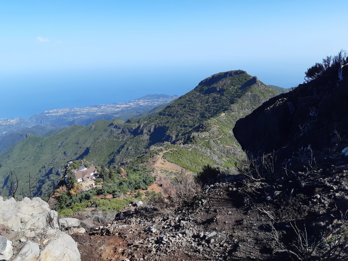
The full PR 1 Vereda do Areeiro crossing is short and hard: 6.1 km and about 3 hours on paper, graded moderate, with steep steps, tunnels and exposed ridges between three summits. Pico do Areeiro stands at 1,818 m, Pico das Torres at 1,851 m and Pico Ruivo at 1,862 m, and the path dips to 1,491 m between them. Staircases drop and climb straight back up, which is why hikers who have walked it grade it hard and bring poles. Six tunnels, 80 m to 300 m long, cut through the volcanic rock, and a staircase carved in the rock takes the path round Pico das Torres. The steepest climb comes last, up to the Casa de Abrigo do Pico Ruivo hut. From the Pedra Rija Viewpoint onwards the route runs one way only, so nobody walks back along it. The crossing suits fit walkers with a head for heights and a lift arranged at the far end.
How do you get back after Pico Ruivo?
Plan the finish before the start, because PR 1 does not bring you back to Pico do Areeiro. From the Pico Ruivo hut there are two ways off. PR 1.2 runs 2.8 km down to Achada do Teixeira, the quicker exit. PR 1.1 Vereda da Ilha drops 1,376 m over 8.2 km to the village of Ilha, in about 3 hours, leaving the high heath for the laurel forest, where the Madeira firecrest and the chaffinch are common. Take it calmly: that is a long descent on tired legs. Either way, the ride back is yours to arrange, by taxi, private shuttle or a guided tour. PR 1 with PR 1.1 makes the biggest mountain day here. For more ridge walking with a hut at the end of the day, our Dolomites walking holidays guide covers bases, seasons and pace.
Which levada walk fills a whole day?
PR 9 Levada do Caldeirão Verde fills a whole day: 8.7 km each way, 17.4 km in all and about 6:30 hours, graded moderate, with little climbing between 872 m and 1,020 m. It starts at Queimadas Forest Park, beside a shelter built like the traditional houses of Santana, triangular with a thatched roof. Shortly after the start the path joins the levada's terrace, and from there on the forest closes in. The levada dates from the 18th century and still carries water through the laurel forest to the farmland of Faial, past escarpments and mountains. Four tunnels cut through the rock, so pack a torch. The walk ends at the Caldeirão Verde lake, fed by water falling straight down from the stream above. It suits walkers who want distance and forest rather than a summit, and a group happy to make lunch by the lake the turning point.
How do you book a slot on Madeira's walking trails?
Book every classified route ahead online, on the SIMplifica Portal: solo hikers and groups alike need an advance reservation, and each booking picks a trail and an entry slot. Each day is split into entry slots with a set capacity, and a full slot closes, so you choose an earlier or later time. Everyone registers, including walkers exempt from the fee. Same-day and next-day bookings work while space is left. Entry times allow around 15 minutes either side, a little more for hikers linking routes in sequence. A closed trail cannot be booked at all, and a route's status moves between open, restricted and closed as rain, wind and fog come and go. The Institute of Forests and Nature Conservation (IFCN) sets out the booking rules for the classified walking routes in full. Book as soon as your dates are set.
When is the best time for Madeira hikes?
Spring is the best time for Madeira hikes: occasional rain keeps the vegetation lively and the watercourses running well, while longer, brighter days give more time on the trails. Summer brings long sunny days, cooler in the mountains and warmer on the coast. Autumn is quieter, with pleasant days and fewer visitors than summer, and winter still suits the levadas, though the heights turn cooler. In any month, rain, strong winds or fog can close a trail for a while. The table below is theKlub's month-by-month read for one point in the middle of the island, averaged over 2016 to 2025: daily highs and lows, and the days with 1 mm or more of rain or snow. July and August have the fewest wet days; March, October and November the most. Conditions by the sea can differ from these figures.
| Month | High | Low | Rain or snow days |
|---|---|---|---|
| January | 8.5 °C | 3.7 °C | 14.5 |
| February | 8.5 °C | 3.4 °C | 13.9 |
| March | 8.6 °C | 3.5 °C | 18.0 |
| April | 9.7 °C | 4.2 °C | 17.1 |
| May | 10.8 °C | 5.5 °C | 15.7 |
| June | 12.7 °C | 7.5 °C | 15.9 |
| July | 14.7 °C | 9.1 °C | 10.6 |
| August | 16.3 °C | 10.2 °C | 9.6 |
| September | 14.7 °C | 9.5 °C | 16.0 |
| October | 14.1 °C | 8.8 °C | 17.5 |
| November | 11.0 °C | 6.2 °C | 17.9 |
| December | 9.3 °C | 4.7 °C | 16.8 |
Frequently asked questions
Which Madeira hike has the best views?
For mountain views, the PR 1 ridge between Pico do Areeiro and Pico Ruivo crosses three of the island's highest summits, through rock tunnels and over stone stairs, and on a clear day Porto Santo shows on the horizon. For forest and water, Levada das 25 Fontes ends at a lake fed by 25 springs.
How long is the Stairway to Heaven hike in Madeira?
The Stairway to Heaven is the stepped stretch of PR 1 near Pico do Areeiro. Out to the Ninho da Manta viewpoint and back is roughly 3.9 km. PR 1's two-way option runs 1.2 km to the Pedra Rija Viewpoint and 1.2 km back. Both start at 1,818 m and need a booked slot.
Is hiking in Madeira difficult?
It depends on the route. Vereda dos Balcões is graded easy and almost level, while PR 1, PR 8 and PR 9 are graded moderate. Most walks still involve some climbing and descending, and steep, exposed sections may not suit walkers unused to heights. Match the route to your fitness and experience, not just its grade.
What should you be careful of on Madeira hikes?
Mountain weather changes fast: in heavy rain or strong winds, turn back. Cloud can cover the ridges and levada paths turn slippery in rain. Carry waterproofs, spare clothing, a map and a compass, and a torch for levada tunnels. Wear walking boots, since some paths are overgrown or edged with brambles.
Madeira rewards a week that mixes both kinds of path: a levada day under the laurels, a half day out at São Lourenço, and one early start on the ridge when the forecast is clear. Keep the crossing for the clearest morning and a levada for the cloudy one. For the stays theKlub rates on the island, start with hiking in Madeira, and for other islands and ranges, see hiking holidays with theKlub. Book your PR 1 slot first, because it is the walk the rest of the week fits around.


