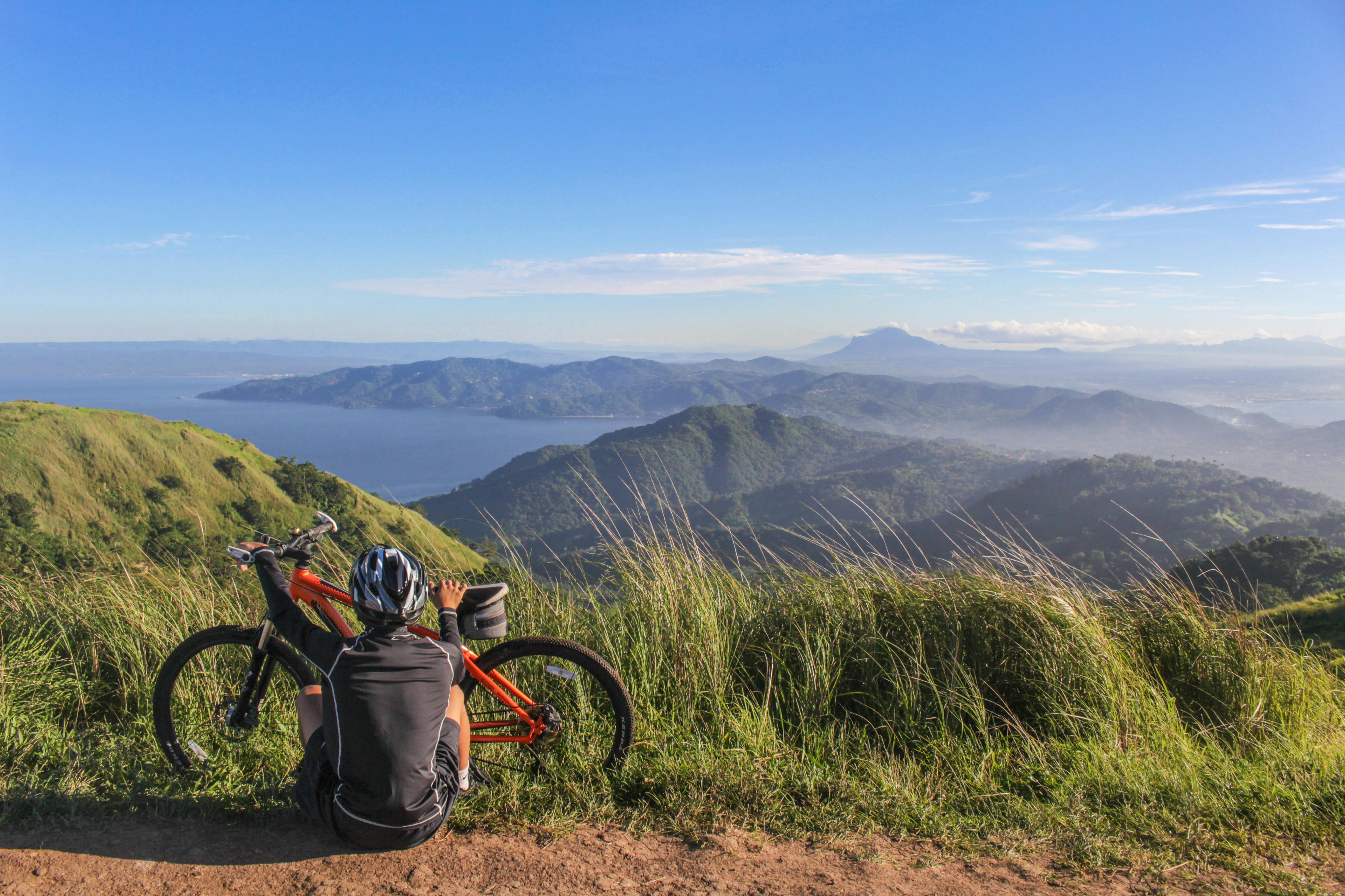
Cycling has a way of revealing places differently. The view you shared with a friend at the top of a climb. The laughs at the café stop when the legs were completely gone. The local couple who slowed their car just to check you were alright. And that sandwich. Maybe it really was the best you’ve ever had, or maybe you were just that hungry. Does it matter?
Across Europe there are routes cyclists talk about for years. These are seven of them. The kind of rides that stay with you long after the legs recover.
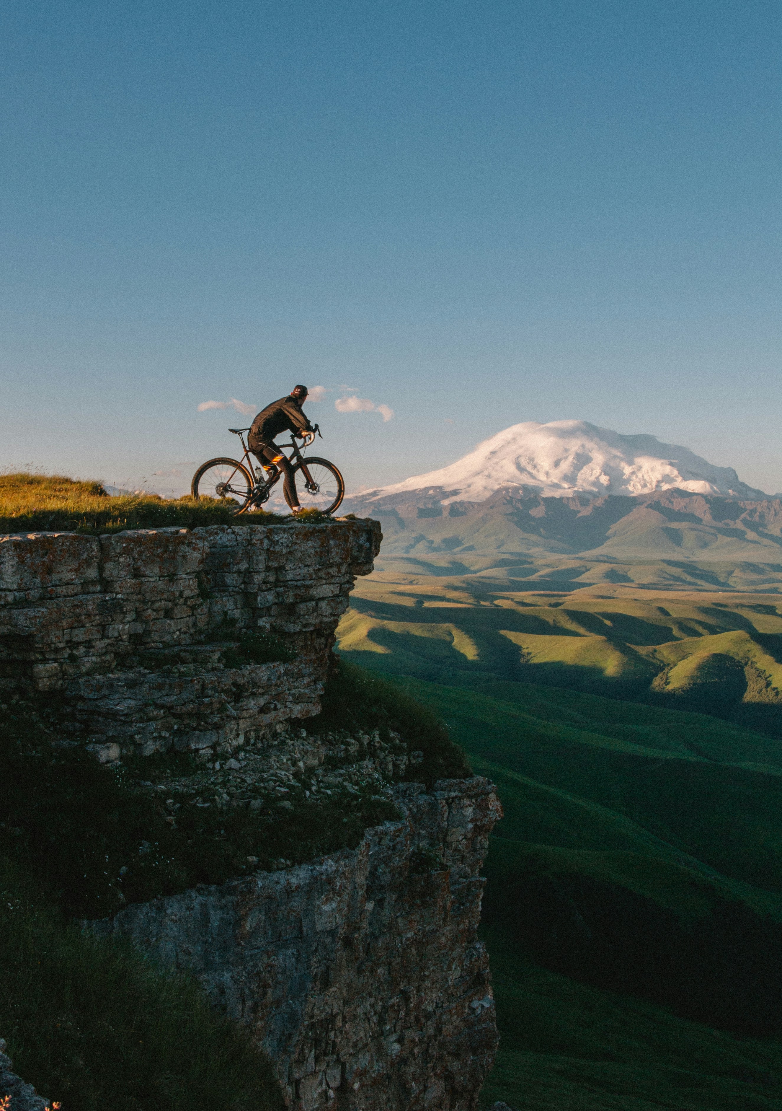
Rallarvegen gravel route, Norway
Why we picked it
Rallarvegen is gravel riding on a high mountain railway service road with real alpine scenery and a neat logistics option: the Bergensbanen railway. Ride up to Finse and then roll or descend toward Flåm for a long, varied day.
Route highlights
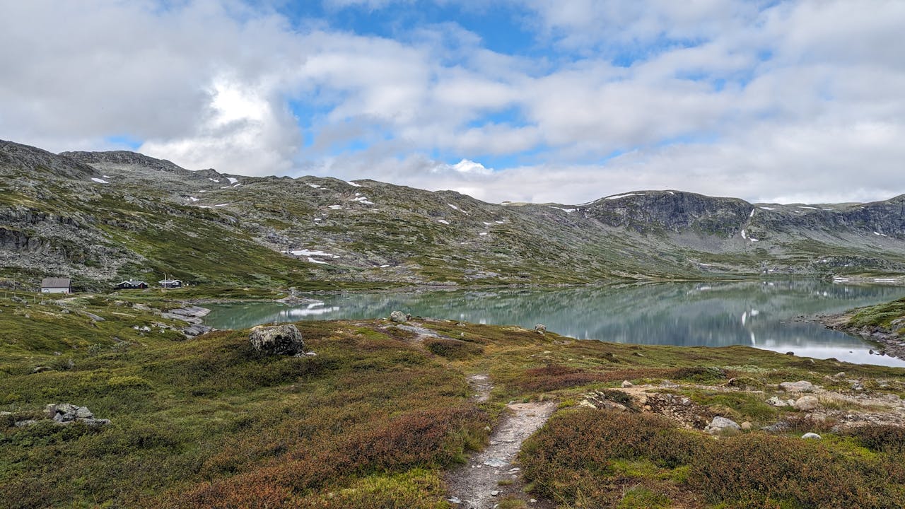
Typical staged ride: Haugastøl to Flåm, about 50 miles with roughly 3,900 feet of climbing (common mapped variations)
Surface: mainly compacted gravel with short paved links and occasional singletrack near stations
Key sections: Haugastøl start, long plateau to Finse (the highest station), then the descending run toward Myrdal and Flåm
Season: best July to September; snow can linger into summer around Finse
Full route breakdown
Start at Haugastøl and follow the graded navvies’ road across the Hardangervidda plateau to Finse. Expect steady, exposed rolling gravel across tundra. After Finse the surface tightens in places and the route follows valley lines toward Myrdal; the final section down into Flåm is a long descent with several technical switchbacks.
Logistics
You can travel to Haugastøl and Finse on the Bergen line; reserve a bike space on the train before you go. Accommodation in Finse and Flåm sells out early in summer so book in advance. The plateau is exposed and the weather changes fast — pack a compact waterproof and warm midlayer. Use wider tyres and carry spare tubes; the route is mostly gravel so punctures are more likely than on smooth tarmac. If you want to avoid a long return, plan the ride as a staged run and take the train back from Flåm or Myrdal. Check the local trail status before you set out, especially early or late in the season.
Rallarvegen — high plateau gravel and long descents to the fjord
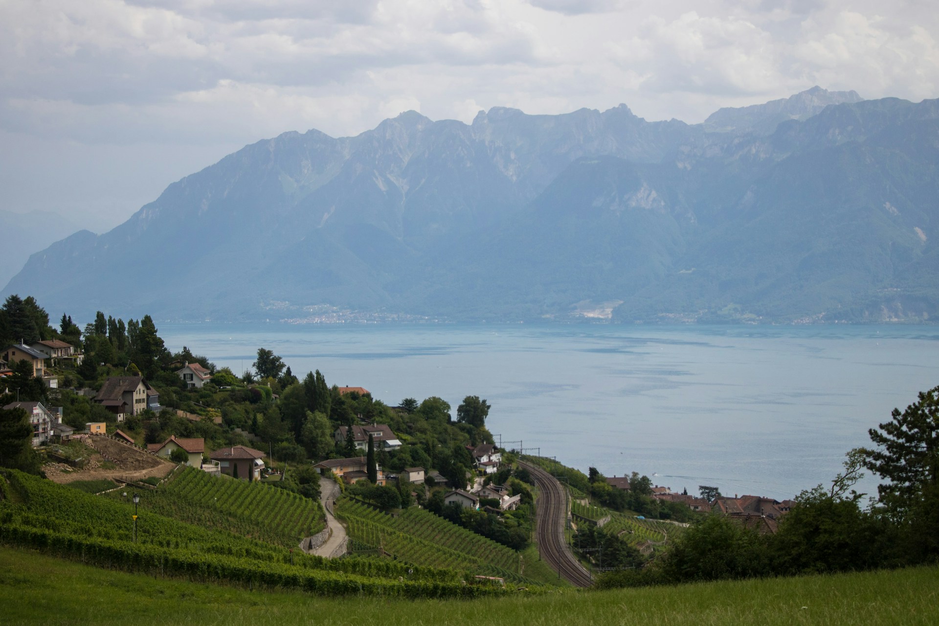
Albula pass, Graubünden, Switzerland
Why we picked it
Albula sits in Graubünden’s network of big passes and is ideal for sustained climbing on clean, well surfaced tarmac. Use it if you want long altitude days with reliable services in valley towns.
Route highlights
Part of Graubünden’s pass network including Bernina, Julier and Maloja — easy to link passes for a multi‑pass day
Road quality: well marked national routes with regular maintenance and signposting
Scenery: high valleys, classic alpine hairpins and long descents that stay largely road‑legal for bikes
Full route breakdown
Common approaches begin from the lower Engadin valleys and climb through a sequence of well surfaced ramps and hairpins to the Albula summit. The ascent is steady with long uninterrupted kilometres that suit tempo riding; the descent on the other side drops into traditional Rhätian towns where services and accommodation are predictable.
Logistics
Base yourself in the Engadin or St Moritz area for easy access to the passes and reliable hotel support for bikes. Train connections serve many valley towns but rules about carrying bikes vary by service, so reserve space if the operator requires it. Mountain passes in Graubünden can be closed or affected by snow in shoulder months; confirm road openings with local authorities before you leave. Pack windproof layers for cold descents and plan your food stops in the valley towns — services are regular there but sparse at altitude.
Albula region — long tarmac climbs and alpine descents
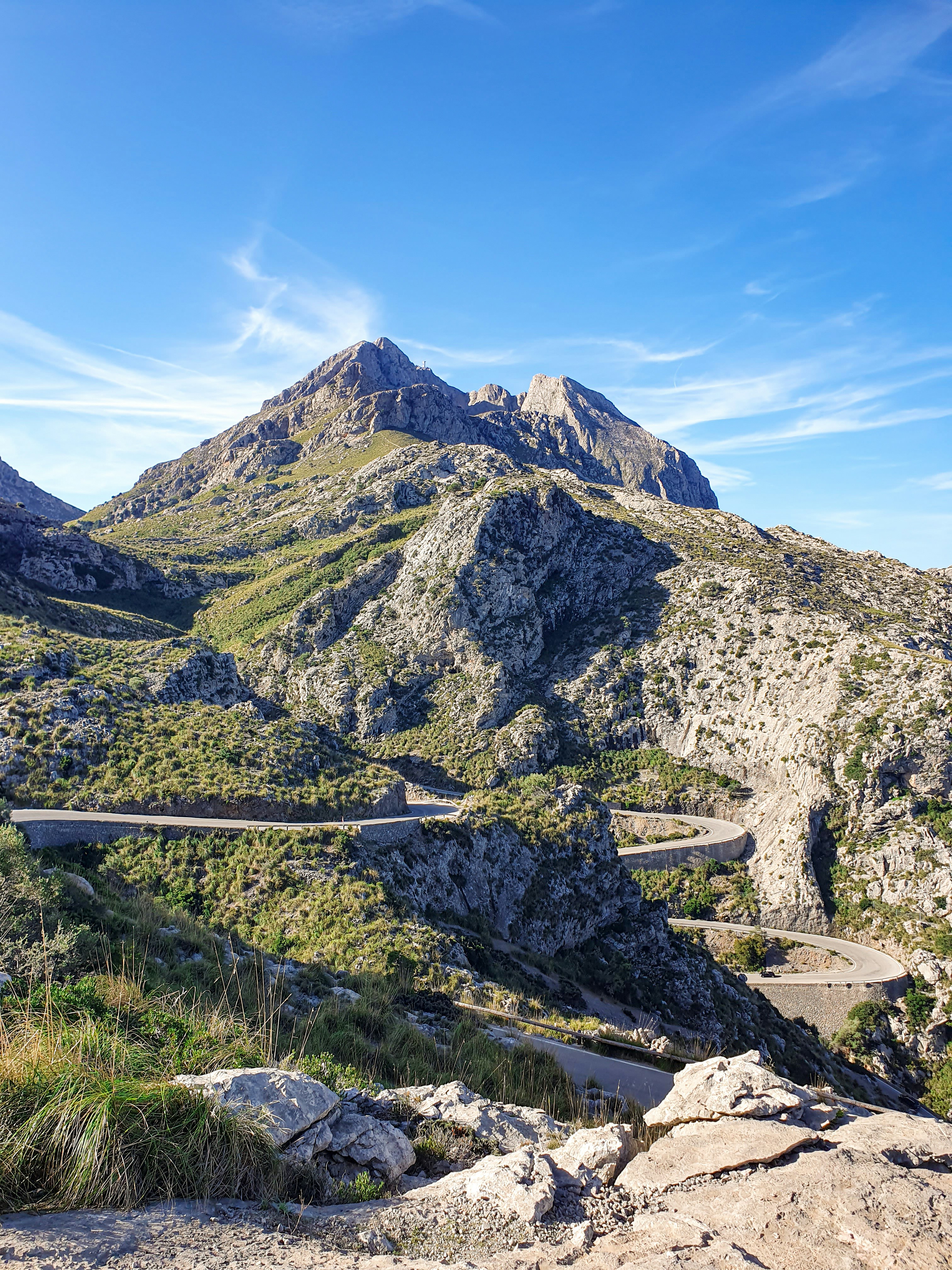
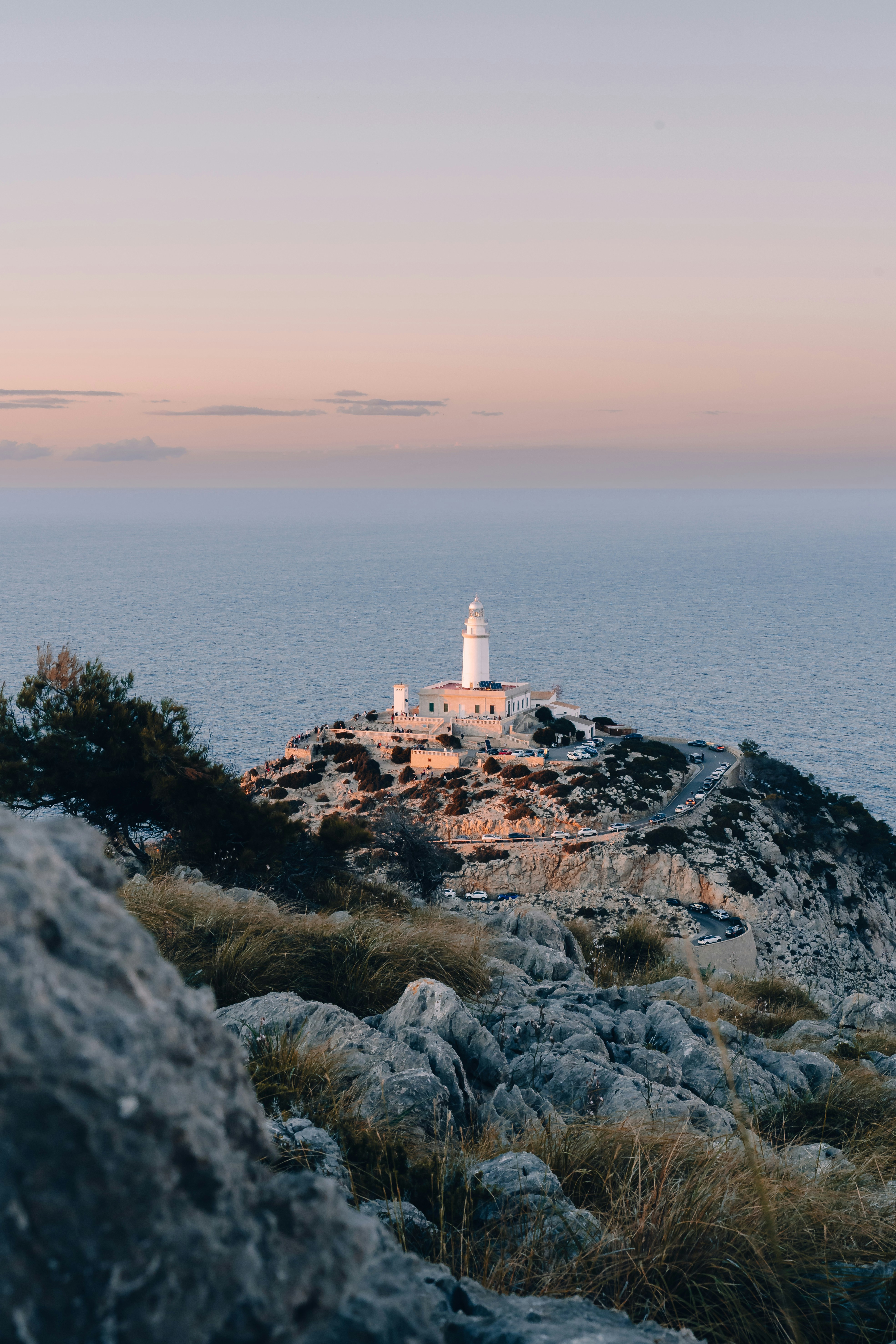
Sa Calobra loop, Mallorca
Why we picked it
Sa Calobra gives short, intense climbing and one of the most recognisable descents in Europe. Most riders include it in a longer northern loop of the Tramuntana to make the most of the approach and the return.
Route highlights
Iconic switchbacks packed into a short distance — the descent starts tighter than the climb
Surface: excellent mountain tarmac typical of the Tramuntana; roads are narrow and can be busy with tourist traffic in season
Advice: ride it early to avoid crowds and traffic; combine with other Tramuntana cols for a full day
Full route breakdown
A typical northern loop includes several Tramuntana passes that lead to the Sa Calobra descent. You generally approach Sa Calobra via a longer climb into the cirque that feeds the switchbacks; the road down is technical and exposed in places, so steady braking and fresh pads are important.
Logistics
Start in the north early — Port de Pollença or Pollensa give the quickest access. The area is a tourist magnet in high season; set off at first light to avoid coach and rental car traffic. There is a short tunnel on the headland in some nearby routes; carry a small light if you want to ride early and remove sunglasses before entering. The final tight descent into Sa Calobra is exposed; check the weather forecast and avoid heavy rain when roads can be slippery and rockfall risk rises. If you plan a northern loop, map your refuelling towns in advance because some cafés close out of season.
Sa Calobra — famous switchbacks and a technical descent
Rocacorba climb, Girona
Why we picked it
Rocacorba is Girona’s go‑to training climb. It’s short enough for repeated efforts and steep enough to test form, with less traffic than many famous climbs.
Route highlights
Steep pitches with repeated sections above 10 percent, ideal for intervals and testing power
Location: close to Girona so you can ride out from town, hit the climb and return to cafes and bike services
Surface: smooth tarmac and reliable local bike support
Full route breakdown
Ride from central Girona and join the local lanes out toward the climb. The ascent itself is mixed pitches, several short steep ramps and a technical summit area used by locals for intervals. The descent back into town is rewarding but take care on narrow sections.
Logistics
Girona is a bike‑friendly town with multiple hire and service options and plenty of cafés for a post‑ride coffee. If you are staying in the centre, you can be on the climb within 30 to 45 minutes. Book bike hire in advance in spring and early autumn. Bring spare tubes and a pump — the climb is steep and punctures are possible on narrow sections. Check shop opening times for late‑season rides as mechanics may have reduced hours.
Rocacorba — steep training climb with sharp pitches
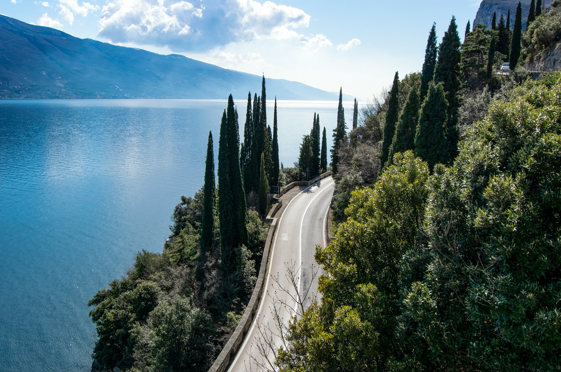
Ponale road, Lake Garda
Why we picked it
Ponale is short, dramatic and gives big lake views without committing to a full mountain day. It makes for a sharp, photo‑worthy climb or part of a longer Garda loop.
Route highlights
Length roughly 5 miles with sustained views above Riva del Garda — the classic upper lake approach
Road detail: narrow cliffside tarmac with exposed sections and multiple photo points
Connections: link to Monte Baldo climbs for much more vertical if you want a full mountain day
Full route breakdown
Start in Riva del Garda and follow the Ponale road as it climbs the cliffside with lake views. The road is mainly paved and narrow with a steady gradient; it soon opens to viewpoints and then can be linked to longer climbs north or to rolling wine country in the south.
Logistics
Ferries and shuttle services operate on sections of Lake Garda and can change your route planning, so check timetables for the day. Parking in Riva can be limited during events; arrive early if you drive. The Ponale road is narrow in places and shared with walkers — take care on blind bends and slow down at popular viewpoints. Seasonal construction and path works on lake projects mean route maps change; consult local tourist information on arrival to confirm open paths and closures.
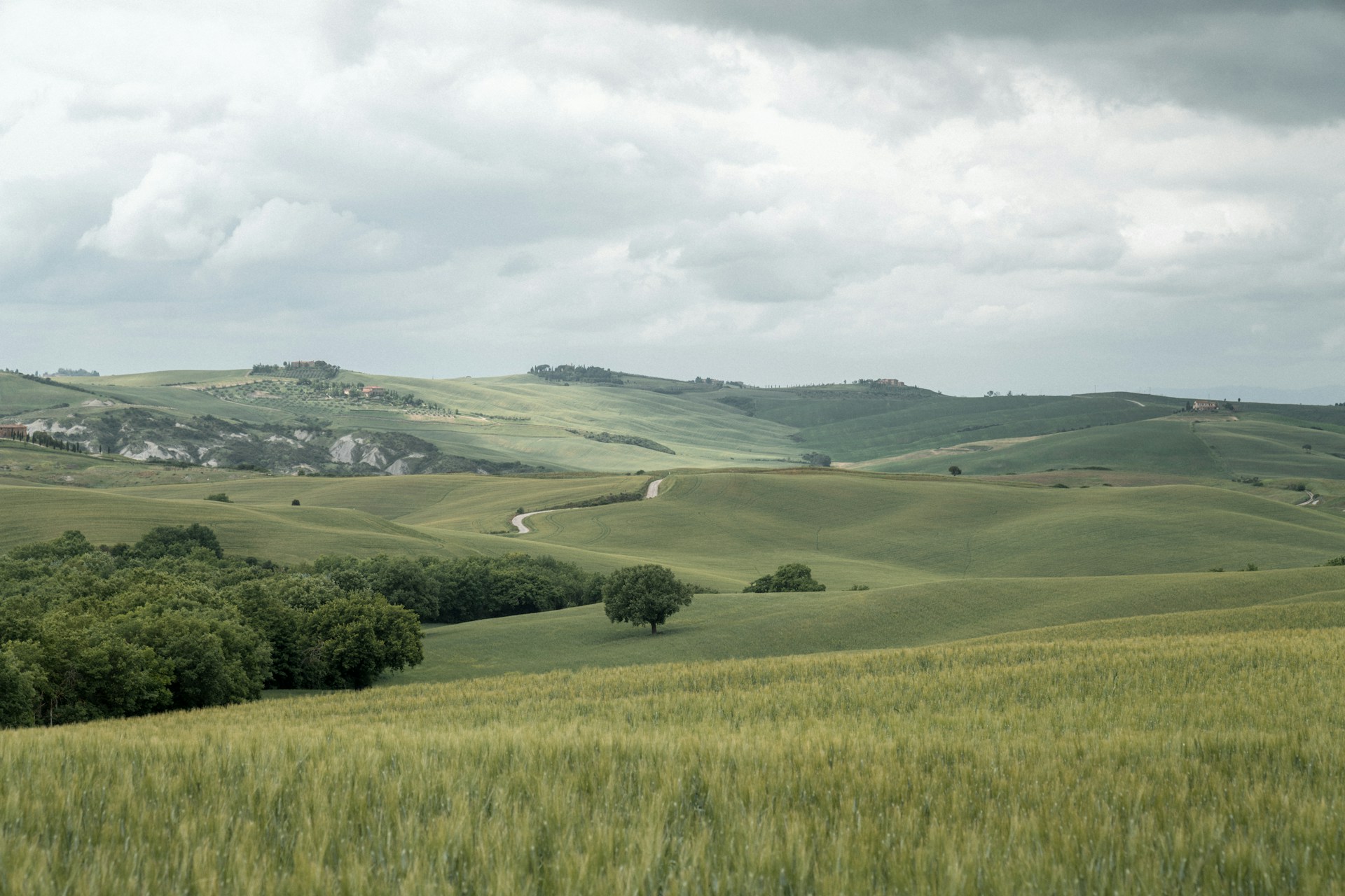
Val d’Orcia is classic Tuscan riding: short climbs, quiet lanes and reliable food stops. It’s an easy‑to‑plan loop that rewards you with hilltop towns and tasting stops.
Route highlights
Typical loop: San Quirico d’Orcia to Pienza to Monticchiello and back — about 19 to 22 miles with roughly 1,300 to 1,640 feet of climbing
Surfaces: mostly paved country lanes with occasional white gravel sections used in Strade Bianche events
Food: Pienza for pecorino and espresso, Monticchiello for sit‑down lunches
Full route breakdown
The loop starts in San Quirico, climbs gently toward Pienza with several short, punchy hills, then threads through Monticchiello before returning. Roads are narrow; you will stop frequently for views and food. Gravel sections exist nearby if you want to add a dirt detour.
Logistics
Plan this one in spring or autumn for the best temperatures and light. Many rural cafés and agriturismos close in mid‑winter, so check opening times if you are riding off season and carry some cash for small family‑run stops. Parking in hilltop towns is limited; consider starting in San Quirico or Pienza so you can cycle out and back without moving your car. If you use an e bike, you will find the short climbs very manageable for mixed groups.
Val d’Orcia — rolling hills and hilltop lunch stops
Red Squirrel Trail, Isle of Wight
Why we picked it
The Red Squirrel Trail is a genuinely reliable family route that follows old railway lines across woodlands and estuaries. It’s mostly traffic free and easy to plan in sections.
Route highlights
Official length commonly given as about 32 miles and usually ridden in sections
Surface: smooth converted railway paths with a few short bridleway links
Key stops: Alverstone Mead nature reserve and Pedallers Café at Newchurch; easy parking and bike hire are available
Full route breakdown
The trail runs from East Cowes or Cowes down to Sandown and loops back via Merstone and Newport depending on how you stage it. It’s largely flat, follows disused railway lines and can be split into manageable sections for families — plan for short legs and regular stops.
Logistics
Ferry crossings to the Isle of Wight are frequent and allow you to choose your start town; confirm whether you are bringing a bike or hiring one on the island. The trail has multiple access points with parking at Cowes, Merstone and Sandown; if you want to hire bikes, reserve in advance during school holidays. Pedallers Café is a known stop on the route at Newchurch and is useful for families. The surface is mostly smooth but check for short bridleway links if you are using a trailer or balance‑bike for small children.
Red Squirrel Trail — traffic free and family friendly
When to go: Alps and Graubünden best June to September; Mallorca March to May and September to October; Lake Garda spring and autumn; Isle of Wight April to October; Tuscany spring and autumn.
What to pack: layers for mountain weather, lights for tunnel sections, sun protection and two bottles for coastal or remote rides.
Bike choice: road bike for Sa Calobra, Rocacorba and Ponale; gravel or mixed tyre for Rallarvegen; hybrids or kids’ bikes for Red Squirrel Trail; e bikes help mixed groups on long climbs.
Local logistics: reserve bike spaces on trains where required, check ferry timetables and local road openings before you set out.
Seven routes across Europe. Different landscapes, different climbs, different kinds of days on the bike. Some will test your legs. Others will leave more space to look around and enjoy the road. Pick one that speaks to you and start planning the ride. The climb, the café stop, the view you stop for longer than expected. And if the day ends with tired legs, good coffee and a story worth telling, it was a good one.